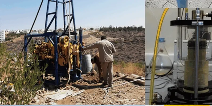
The geophone spread stretches 230 meters across the desert crust, twelve-pound sledgehammer striking the aluminum plate in a rhythmic cadence—every impact sending elastic waves deep into the Mesa formation. We run a 48-channel seismograph with 4.5 Hz vertical geophones spaced at 5-foot intervals, capturing first arrivals and reflected phases across the unsaturated gravels and caliche horizons that dominate the eastern Valley. The raw shot gathers look chaotic on screen, but after muting ground roll and applying elevation statics for the subtle basin slope, the refraction tomogram resolves a clear velocity gradient from 1,200 ft/s in the colluvium to over 8,000 ft/s at the top of the cemented conglomerate. A seismic refraction survey configured this way gives us continuous P-wave coverage without the interpolation gaps you get from borehole-only investigations, which matters when the caliche pinches out unexpectedly between two apparently similar lots in the Superstition Springs area.
The caliche layer in Mesa is not a uniform slab—velocity inversions and buried channels are common, and only continuous seismic profiling catches them.
Local geotechnical context
The most expensive mistake we see in Mesa is relying exclusively on rotary wash borings to map bedrock depth, then discovering during pier drilling that the caliche surface undulates five or six feet across a single column grid. The driller hits refusal early on one pier and has to over-drill the adjacent one—suddenly the rebar cages don’t match, the contractor files a change order, and the geotechnical report gets scrutinized for missing a known basin-fill irregularity. Mesa sits on the eastern flank of the Salt River Valley, where Pleistocene alluvial fans interfinger with fine-grained lake deposits and secondary carbonate cementation varies wildly. A refraction line run between every third boring eliminates this guessing game: the velocity tomogram shows exactly where the high-impedance contact sits, and a reflection profile can resolve internal bedding within the caliche that affects socket design. We’ve also mapped undocumented faults with less than 10 feet of vertical offset—structurally insignificant for most buildings, but critical when you’re designing a retaining wall that crosses the trace at an oblique angle.
Common questions
What depth can seismic tomography reach in Mesa’s geology?
Refraction surveys with a sledgehammer source typically image to 80–120 feet in the cemented alluvium and caliche common to Mesa. For deeper targets, we switch to an accelerated weight drop or a small explosive charge, which can extend the investigation to 200–300 feet. Reflection profiling depth depends on the target reflectivity and fold, but we’ve mapped the basin-fill contact at over 400 feet in the East Valley. The limiting factor is usually the velocity contrast: caliche over softer clay produces a strong impedance difference, while gradational contacts may not return a clear reflection.
How much does a seismic tomography survey cost in Mesa?
For a typical commercial lot survey with two refraction lines totaling 600–800 linear feet, budgets generally fall between US$3,070 and US$5,880. The range depends on line length, number of shots, need for reflection processing, and whether we’re deploying a 24- or 48-channel array. A combined refraction-plus-reflection survey on a larger site with multiple lines and depth migration will trend toward the upper end. We provide a fixed-price proposal after reviewing the site plan and target depths.
Can seismic tomography detect voids or sinkholes in the caliche?
Yes, with the right acquisition parameters. Air-filled voids produce a strong velocity anomaly in refraction tomograms—the ray paths deflect around the low-velocity zone—and a diffraction hyperbola in reflection sections. In Mesa, dissolution features within the caliche are less common than in limestone karst, but we have identified collapsed zones associated with old irrigation channels and buried arroyos. The key is using a dense geophone spacing (2.5 feet or less) and recording high-frequency data above 100 Hz to resolve small-scale features.
How does seismic tomography compare to MASW for site classification?
They answer different questions. Seismic refraction gives us a P-wave velocity model tied directly to depth, which we convert to rippability, rock quality, and dynamic Poisson’s ratio. MASW measures shear-wave velocity (Vs) averaged over a receiver spread, which feeds directly into the Vs30 calculation for IBC seismic site class. On most Mesa projects we run both: MASW for the ASCE 7 site classification letter, and refraction tomography for the continuous bedrock map. The two datasets can be combined to derive a full suite of dynamic elastic moduli.