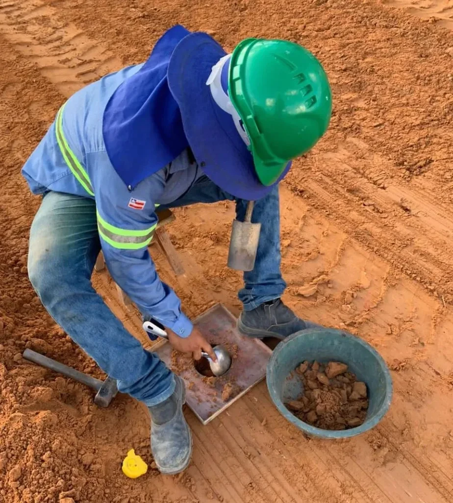
Mesa's transformation from a small agricultural settlement on the old Hohokam canals into Arizona's third-largest city brought a specific geotechnical challenge: verifying compaction on the heterogeneous alluvial fans of the Salt River Valley. With over half a million residents spread across 138 square miles, new commercial pads in Eastmark and utility trenches in Dobson Ranch encounter everything from clean sands to silty gravels. A properly executed field density test using the sand cone method (ASTM D1556) gives us the direct, physical measurement that nuclear gauges sometimes fail to deliver in these mixed soils. We have applied this procedure on hundreds of projects, from school additions to fire station aprons, and the correlation between a well-run sand cone test and long-term pavement performance is something we document routinely. For deeper stratigraphic profiling before compaction begins, our team often recommends supplementing with CPT soundings to identify loose zones that may require over-excavation.
A single failed density test on a utility trench backfill in Mesa's expansive clay zones can delay a subdivision acceptance by weeks—we catch these issues during construction, not after.
Local geotechnical context
In Mesa, we frequently encounter undocumented fill from the 1970s and 1980s housing boom, particularly in older neighborhoods west of Country Club Drive. This material often contains construction debris, gypsum board scraps, and organic trash that no modern compaction specification would allow. Relying solely on a nuclear density gauge in these conditions can produce misleading readings because the hydrogen content in gypsum and organics skews the moisture measurement. The sand cone method eliminates that chemical interference entirely. A more serious risk is the presence of collapsing soils—low-density silty sands that stand up when dry but lose volume instantly when wetted. These are notorious in the Queen Creek area south of the 60. A sand cone test that shows 85% relative density in a backfill lift that should be at 95% is often the first indicator of a much larger soil structure problem, and we treat it as a red flag that demands immediate investigation.
Common questions
How much does a field density test (sand cone method) cost in Mesa?
For a single sand cone density test in Mesa, the cost typically runs between US$100 and US$140 per point when performed as part of a larger testing program. The final price depends on the number of tests per day, site accessibility, and whether we are also providing the laboratory Proctor curve. A half-day minimum applies for most sites, and we recommend grouping at least six to eight tests per visit to achieve the best unit rate.
How many sand cone tests does the City of Mesa require for a building pad?
The City of Mesa typically requires a minimum of one field density test per lift per 2,500 square feet of building pad area, or per 150 linear feet of utility trench. The exact frequency is specified in the project's geotechnical report and the soils special inspection requirements. For critical structures like fire stations or schools, we often see tighter grids—one test per 1,500 square feet—and we coordinate with the special inspector to meet that frequency without slowing down the earthwork contractor.
What is the difference between the sand cone method and a nuclear density gauge?
The sand cone method (ASTM D1556) measures density directly by excavating soil, weighing it, and replacing the volume with calibrated sand. It is unaffected by soil chemistry, organic content, or buried debris. A nuclear gauge (ASTM D6938) measures density indirectly using gamma radiation and is faster but can produce erroneous readings in soils with high organic content, gypsum, or irregular voids—conditions we see often in older Mesa fill. We use sand cone as the referee method when nuclear gauge results are questionable or when the project specification explicitly requires a direct measurement.
How long does it take to get the density test results on site?
We provide a verbal pass/fail result to the contractor within 30 minutes of completing the test hole excavation. The moisture content determination by direct heating on a gas burner or microwave is done on the tailgate immediately after weighing the excavated soil. A formal written report with all calculations, GPS location, and specification comparison is delivered electronically by the end of the same business day. We know that a scraper crew waiting for a density result costs money, so we prioritize speed without sacrificing accuracy.